How Architectural Rendering Services Help Smart City Planning
Introduction
Smart cities are designed to make life easier, safer, and more efficient. They focus on better transportation, energy efficiency, digital connectivity, and improved public spaces. However, when planners try to design these systems using only traditional 2D drawings, they often face limitations. These drawings cannot fully capture the depth, scale, or real-life experience of a space.
This lack of clarity can lead to confusion among stakeholders, delays in approvals, and even costly design errors. Architectural Rendering Services help solve this problem by turning ideas into clear, visual formats that are easy to understand. With realistic images and immersive experiences, planners can present their vision in a way that feels real from the very beginning.
What Are Architectural Rendering Services?
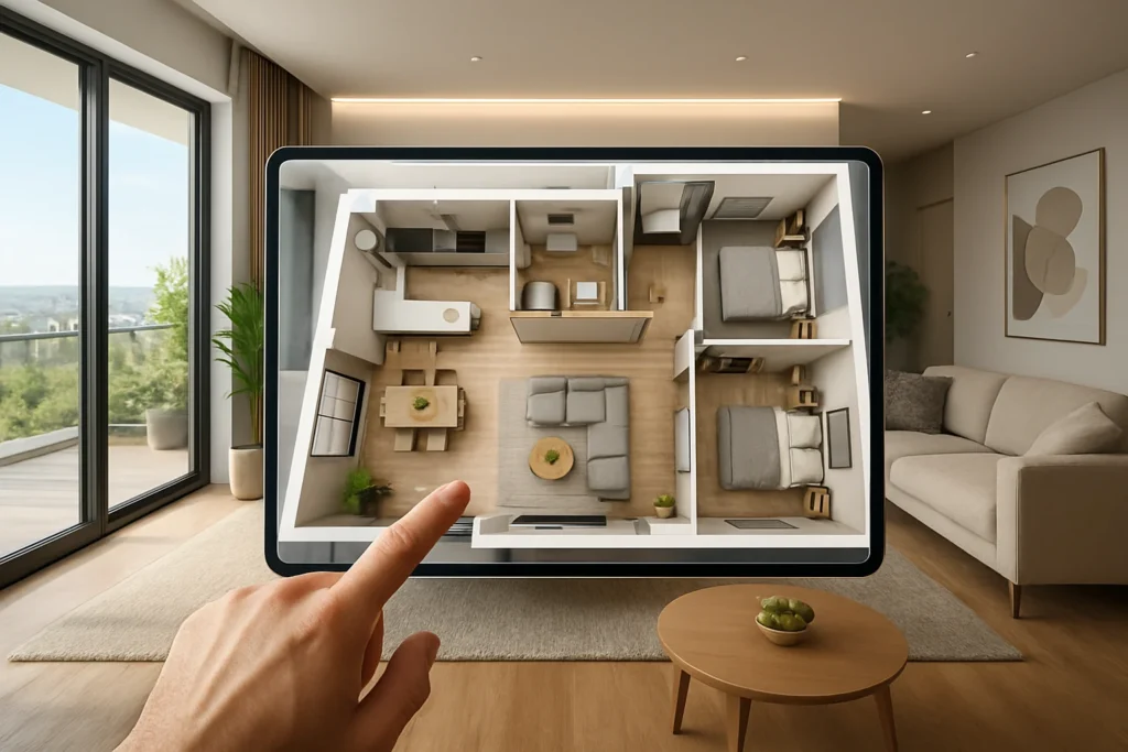
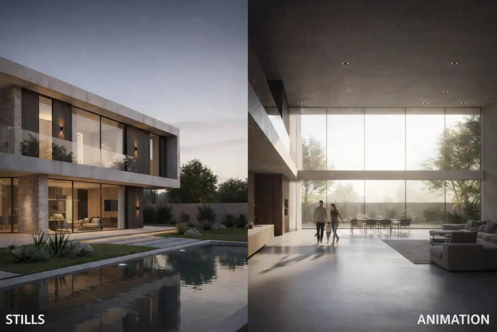
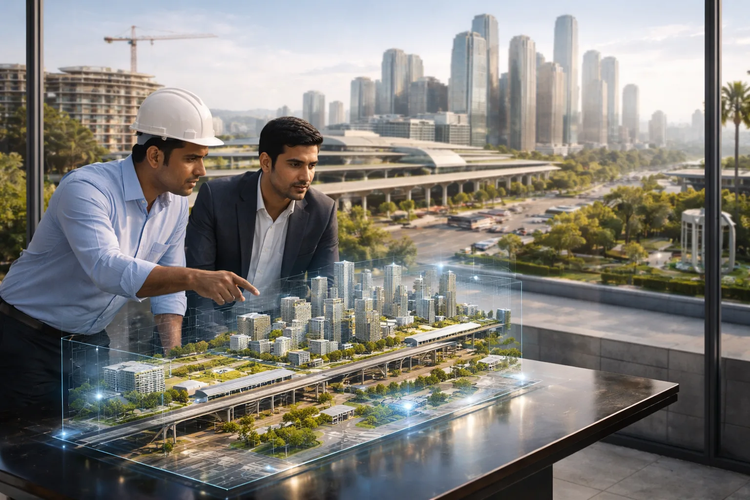
Architectural Rendering Services refer to the process of creating detailed and realistic visuals of buildings, spaces, and entire urban areas before they are constructed. These visuals can include still images, animations, aerial views, and interactive walkthroughs that allow users to explore a space virtually.
Unlike technical drawings, which require professional knowledge to interpret, renderings are designed for everyone. Whether it is a client, investor, or government official, anyone can understand what the final project will look like. This makes communication more effective and reduces the chances of misunderstandings.
Over time, Architectural Rendering Services have evolved from simple sketches to highly advanced digital visuals powered by modern software and real-time technologies.
The Connection Between Smart City Planning and Visualization
Smart city planning involves designing entire ecosystems where infrastructure, technology, and human activity work together. This includes residential areas, commercial zones, transportation networks, and public facilities. Managing all these elements requires a clear and unified vision.
Architectural Rendering Services help bring this vision together by offering a complete visual overview of the project. Instead of looking at separate plans for each component, stakeholders can see how everything fits into one cohesive design. This makes it easier to identify gaps, adjust layouts, and ensure that all parts of the city function smoothly.
Visualization also helps bridge the gap between technical experts and decision-makers, ensuring that everyone is on the same page.
How 3D City Models Help in Early Planning Decisions
One of the biggest advantages of using Architectural Rendering Services is the ability to make better decisions early in the planning stage. 3D city models allow planners to test different ideas and see how they will work in a real-world context.
For example, planners can experiment with building placements, road networks, and open spaces to find the most efficient layout. They can also study how different elements interact with each other, such as how traffic flows through a particular area or how sunlight affects building interiors.
By identifying potential issues at an early stage, Architectural Rendering Services help reduce the risk of costly changes later in the project. This not only saves money but also keeps the project timeline on track.
Making Complex Urban Ideas Easy to Understand
Urban planning often involves technical concepts that are difficult for non-experts to understand. This can create challenges when presenting ideas to clients, investors, or the general public.
Architectural Rendering Services simplify these complex ideas by presenting them in a visual format that anyone can understand. A realistic rendering can show how a neighborhood will look, how people will move through it, and how different spaces will be used.
This clarity makes it easier for stakeholders to provide feedback, approve designs, and feel confident about the project. It also helps avoid confusion that can arise from interpreting technical documents.
Supporting Sustainable and Eco-Friendly City Design
Sustainability is a major focus in smart city development. Planners aim to create spaces that use resources efficiently, reduce environmental impact, and provide a healthy living environment for residents.
Architectural Rendering Services support these goals by allowing planners to visualize environmental factors such as sunlight, airflow, and green spaces. For instance, they can study how natural light enters a building or how wind flows through an open area.
These insights help in making better design decisions that support energy efficiency and environmental balance. By using Architectural Rendering Services, planners can create cities that are not only visually appealing but also environmentally responsible.
Better Collaboration Between Teams
Smart city projects involve multiple professionals, including architects, engineers, urban planners, and developers. Each team brings its own expertise, but coordinating their work can be challenging.
Architectural Rendering Services act as a common platform where all teams can collaborate effectively. Instead of working with separate documents, everyone can refer to the same visual model. This reduces the chances of miscommunication and ensures that all teams are aligned with the project goals.
Better collaboration leads to smoother workflows, faster problem-solving, and improved project outcomes.
Cost and Time Benefits in Urban Development
Large-scale urban projects require significant investment, so managing costs and timelines is critical. Architectural Rendering Services help achieve this by improving planning accuracy and reducing the need for revisions.
When stakeholders can clearly see the final outcome, they are less likely to request major changes during construction. This reduces delays and prevents budget overruns.
Additionally, early detection of design issues helps avoid expensive corrections later. By using Architectural Rendering Services, developers can keep projects on schedule and within budget.
Role in Public Engagement and Smart Governance
Smart cities are designed for people, so public involvement is an important part of the planning process. However, technical plans can be difficult for the general public to understand.
Architectural Rendering Services make it easier to present city projects in a way that is engaging and accessible. Citizens can view realistic visuals or virtual tours of proposed developments, helping them understand how the project will impact their daily lives.
This encourages community participation and allows authorities to gather valuable feedback. It also builds trust, as people feel more involved in the decision-making process.
Real-World Use Cases in Smart Cities
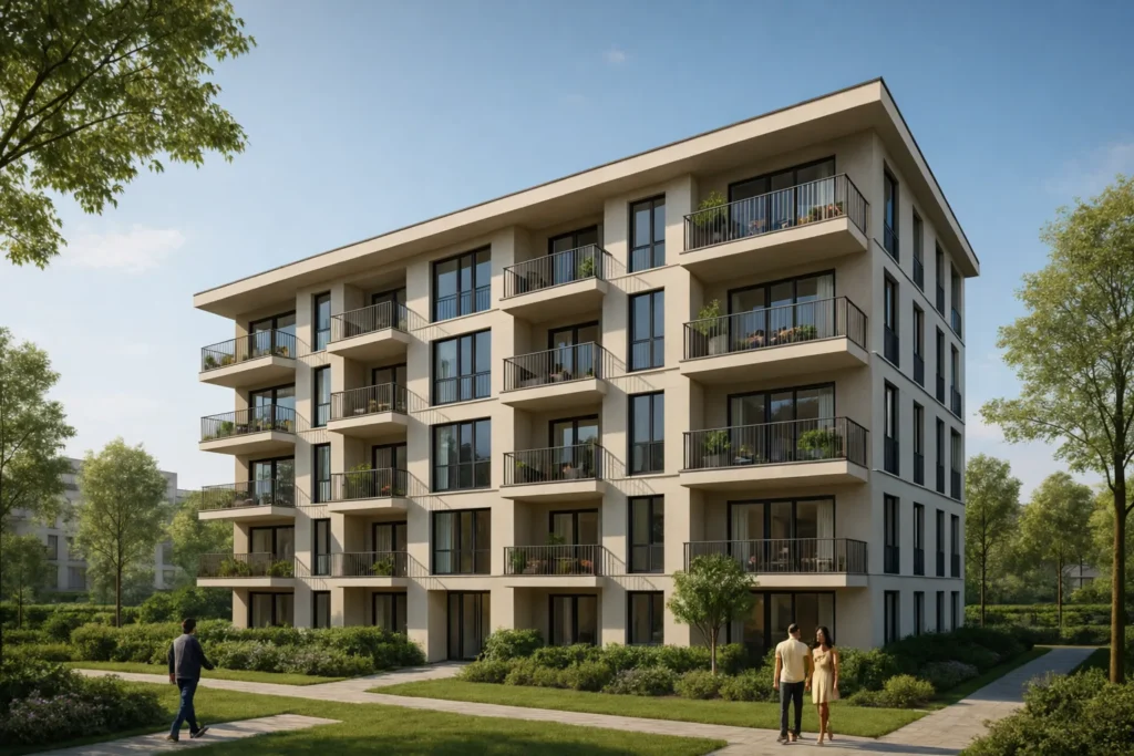
Architectural Rendering Services are used in a wide range of smart city applications. They play a key role in designing residential communities, commercial developments, and mixed-use spaces.
They are also used in infrastructure planning, including roads, bridges, and public transportation systems. By visualizing these elements in detail, planners can ensure that they function efficiently and meet the needs of the population.
Another important use case is in disaster management. Planners can simulate different scenarios, such as floods or traffic congestion, and develop strategies to handle them effectively.
The concept of digital twin cities is also gaining attention, where a virtual model of the city is used to monitor and manage real-world conditions in real time.
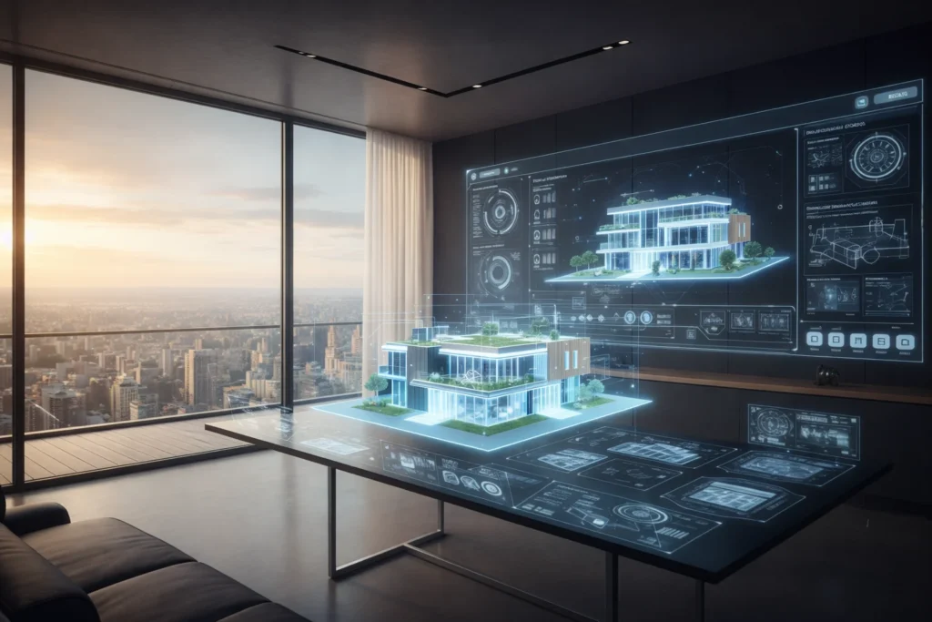
Technologies Behind Modern Rendering
Modern Architectural Rendering Services rely on advanced technologies to create realistic and detailed visuals. 3D modeling software allows designers to build accurate representations of structures and environments.
Building Information Modeling (BIM) and Geographic Information Systems (GIS) help integrate data from different sources, making the models more informative and useful.
Real-time rendering tools allow instant updates, while virtual reality and augmented reality provide immersive experiences. These technologies continue to evolve, making visualizations more interactive and closer to reality.
External Resources
Learn more about BIM here:
Building Information Modeling (BIM)
Explore GIS technology here:
Geographic Information Systems (GIS)
Challenges You Should Know
While Architectural Rendering Services offer many benefits, they also come with certain challenges. High-quality renderings require time, expertise, and resources, which can increase project costs.
There is also a risk of relying too much on visuals without considering practical limitations such as construction feasibility or budget constraints.
Additionally, the accuracy of a rendering depends on the quality of the input data. If the data is incorrect, the final visualization may not accurately represent the real project.
Future of Rendering in Smart City Development
The future of Architectural Rendering Services in smart city planning looks promising. As technology continues to advance, these services will become even more powerful and accessible.
The rise of digital twins will allow cities to be monitored and managed in real time, providing valuable insights for decision-making. Artificial intelligence will further improve the accuracy and efficiency of visualizations.
Architectural Rendering Services will continue to evolve, becoming an essential tool for planners and developers working on complex urban projects.
Conclusion: Why It’s Becoming a Must-Have Tool
In today’s rapidly growing urban environment, clear planning and communication are more important than ever. Architectural Rendering Services provide the tools needed to turn complex ideas into clear and understandable visuals.
They help improve collaboration, support better decision-making, and reduce risks in large-scale developments. From early planning to final execution, they play a vital role in shaping modern cities.
As smart cities continue to develop, Architectural Rendering Services will remain a key part of the process, helping create spaces that are efficient, sustainable, and designed for the future.